Author: Larry St Aubin
Off we head to Ontario, another year older. And one final time to experience Lake Superior. There is a tour called Circle Lake Superior. If I ever do this again I would like to do that. We have a 4 hour drive to Dryden. But first we take our morning walk in Winnipeg.
The Anishinaabe are the original caretakers of this land and called this place Paawidigong, meaning place of the rapids which is now known as Dryden.
This land is important to the people of Migisi Sahgaigan (Eagle Lake First Nation), Waabigonii Zaaga’igan (Wabigoon Lake Ojibway Nation) as well as the Métis people of the area and the residents of Dryden.
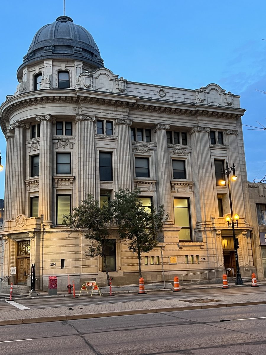
We do a little tour around our Winnipeg hotel before checking out. The former Bank of Nova Scotia, constructed 1908-10. It was on Main Street – away from Bankers Row. The facade is terra cotta from England hung on a steel frame. Architects were the Toronto firm of Darling and Pearson who did many banks across Canada. It was a narrow site so the facade and dome compensated for limited space.
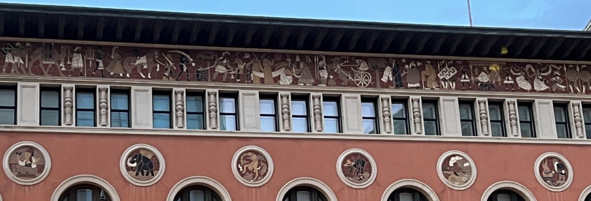
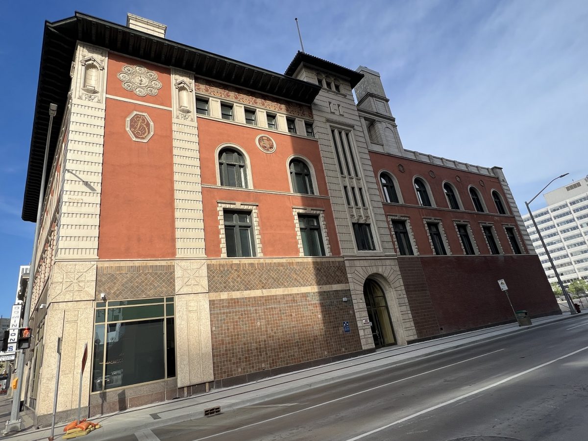
I wanted to get one more closeup of the mosaic designs of the YMCA building. The building has an AVEDA signage but doesn’t appear to be open
On the side of this building is another interesting tidbit. This was the entrance to the Alpine Club of Canada, the national mountaineering organization. Founded in this building in 1906.
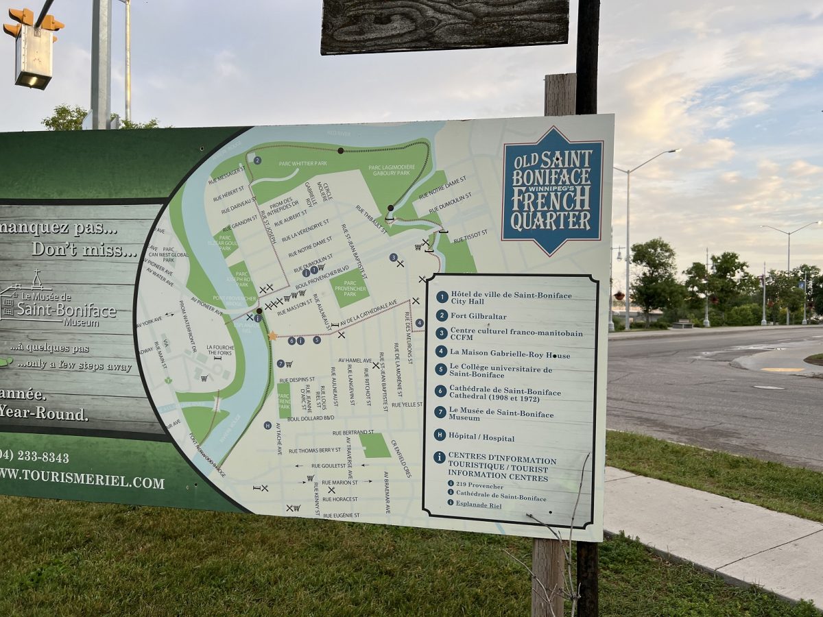
We then headed down to Saint Boniface neighbourhood – Winnipeg’s French Quarter. The have an information map which was really nice of them.
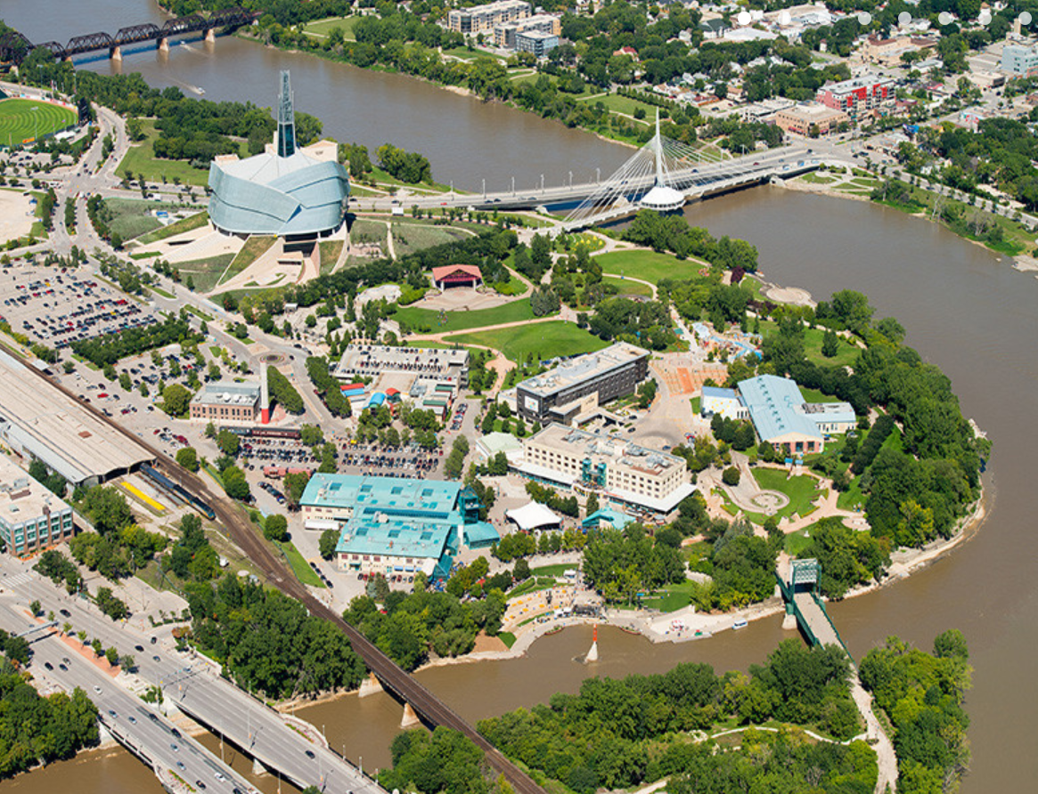
“The Forks is Manitoba’s most-visited tourism attraction for a reason. We start our walking tour here. Spring through fall will see you sitting harbour side on one of Western Canada’s largest patios, with other options including taking a boat tour of the city’s rivers, testing your skills in the Tony Hawk-approved skate plaza and exploring Niizhoziibean—the Indigenous-led area across the rail bridge that is brimming with huge, powerful works of public art. Year-round The Forks Market is an epicurean destination, featuring food kiosks and restaurants from some of the city’s best chefs along with The Common—an indoor and outdoor bar featuring 20 wines and 20 beers on tap that are anything but common. The Forks grounds also feature so much for your little ones, including Manitoba Theatre for Young People, the Children’s Museum and one amazing playground called Fort Parka.”
The Forks is where the Assiniboine River flows into the Red River. Archeological digs unearthed a 6,000 year old hearth. More about the history of the Forks here.
The Canadian Museum of Human Rights on the left and the Esplanade Riel
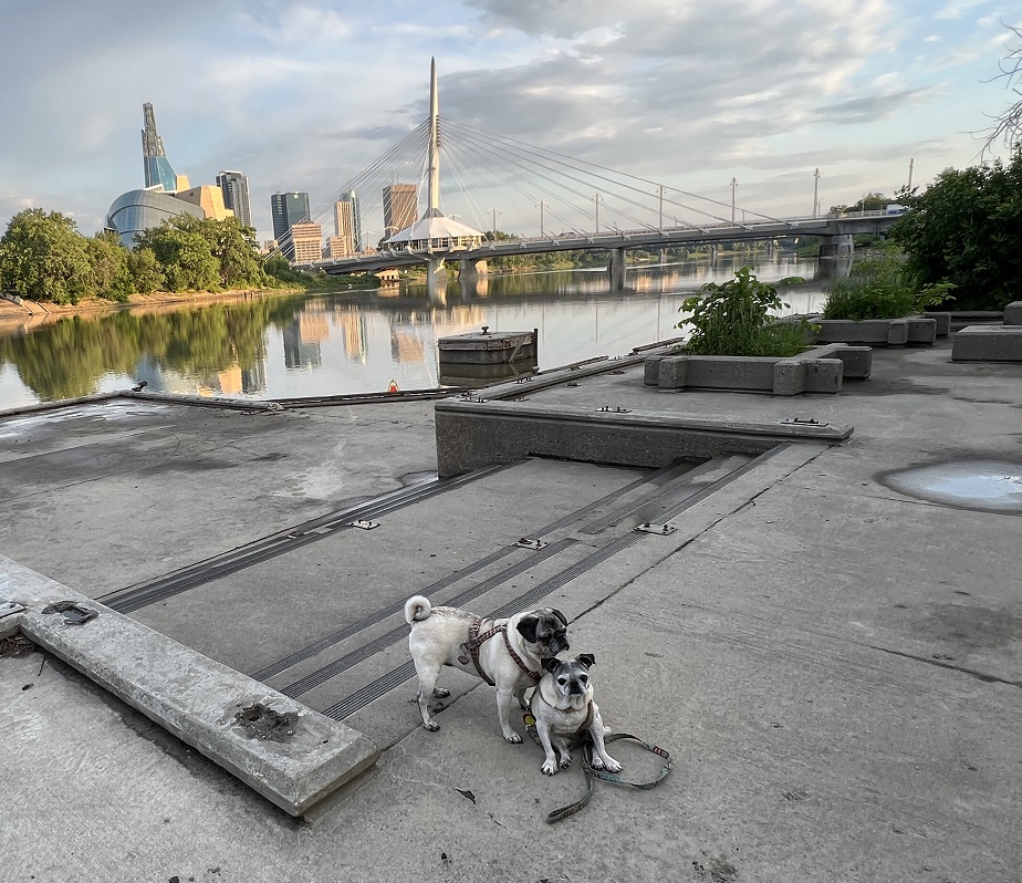
Esplanade Riel. “This five-metre wide and 250-metre long “people path,” is located north of the junction of the historic Red and Assiniboine Rivers, and provides a link between The Forks and Winnipeg’s French Quarter. The structure, cable-stayed from a single, transversely inclined pylon rising 57 metres above the Red River, reflects the lightweight nature of its pedestrian traffic, while the spire signifies a place of meeting in the middle of the Red River. A historical diorama can be viewed from the bridge. The bridge was named in honour of Louis Riel.”
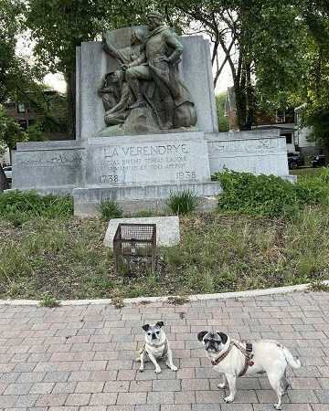
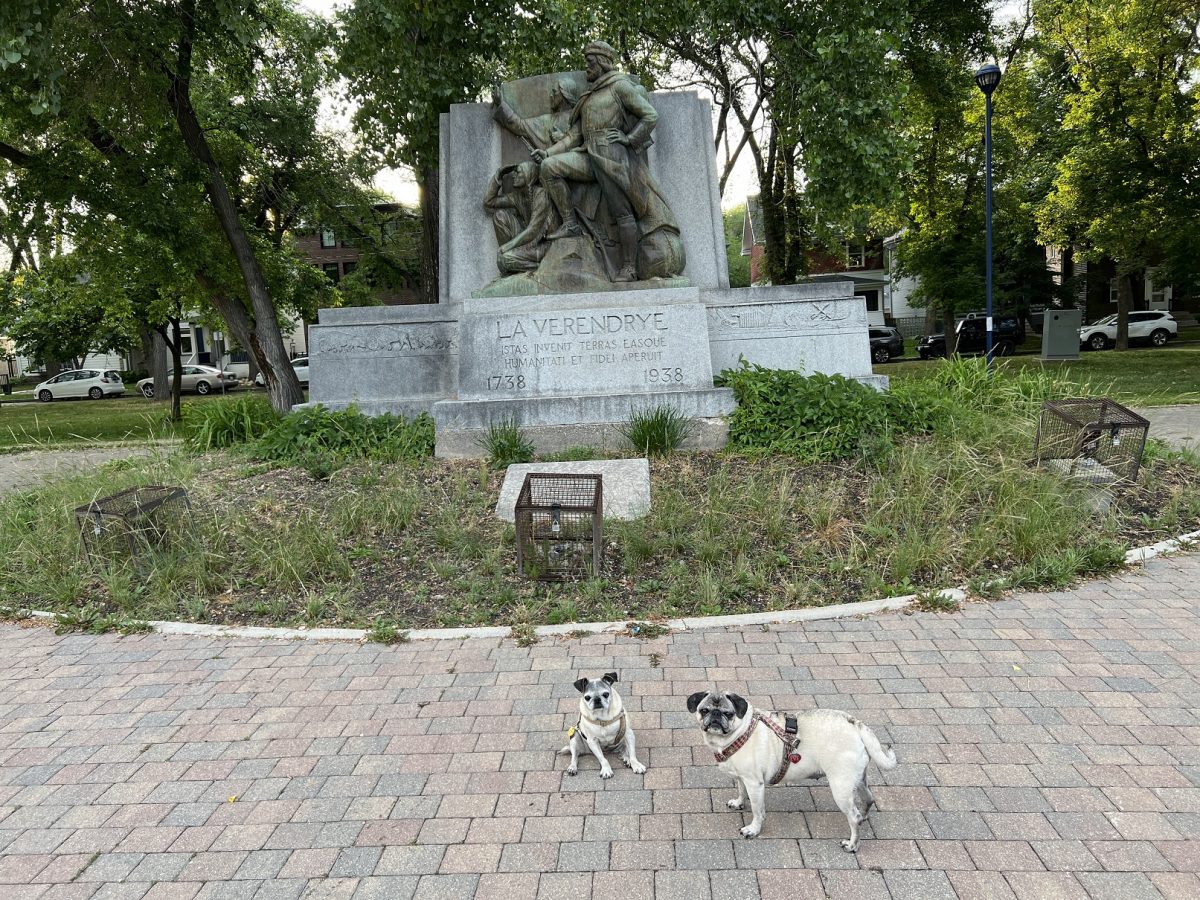
Laverendrye Park, “La Vérendrye Park, on the east side of Taché Avenue from Dollard Boulevard to Rue Despins, contains a large stone monument featuring likenesses of La Vérendrye and several of his colleagues. It was unveiled in 1938. On the ground in front of the monument is a cornerstone blessed by Archbishop Taché in 1886 for a future monument to La Vérendrye.”
Pierre Gaultier de Varennes, Lord of La Verendrye was a pioneer in the exploration of the Northwest continent.
A pair of plaques nearby were erected by the Historic Sites Advisory Board of Manitoba to commemorate the site near this spot where, on 4 September 1812, Miles Macdonell took possession of Assiniboia, the lands granted by the Hudson’s Bay Company to the Earl of Selkirk. Macdonell, the first governor, was attended by officers and servants of the North West Company from Fort Gibraltar which lay across the Red River. The Patent and Macdonell’s commission were read in French and English.
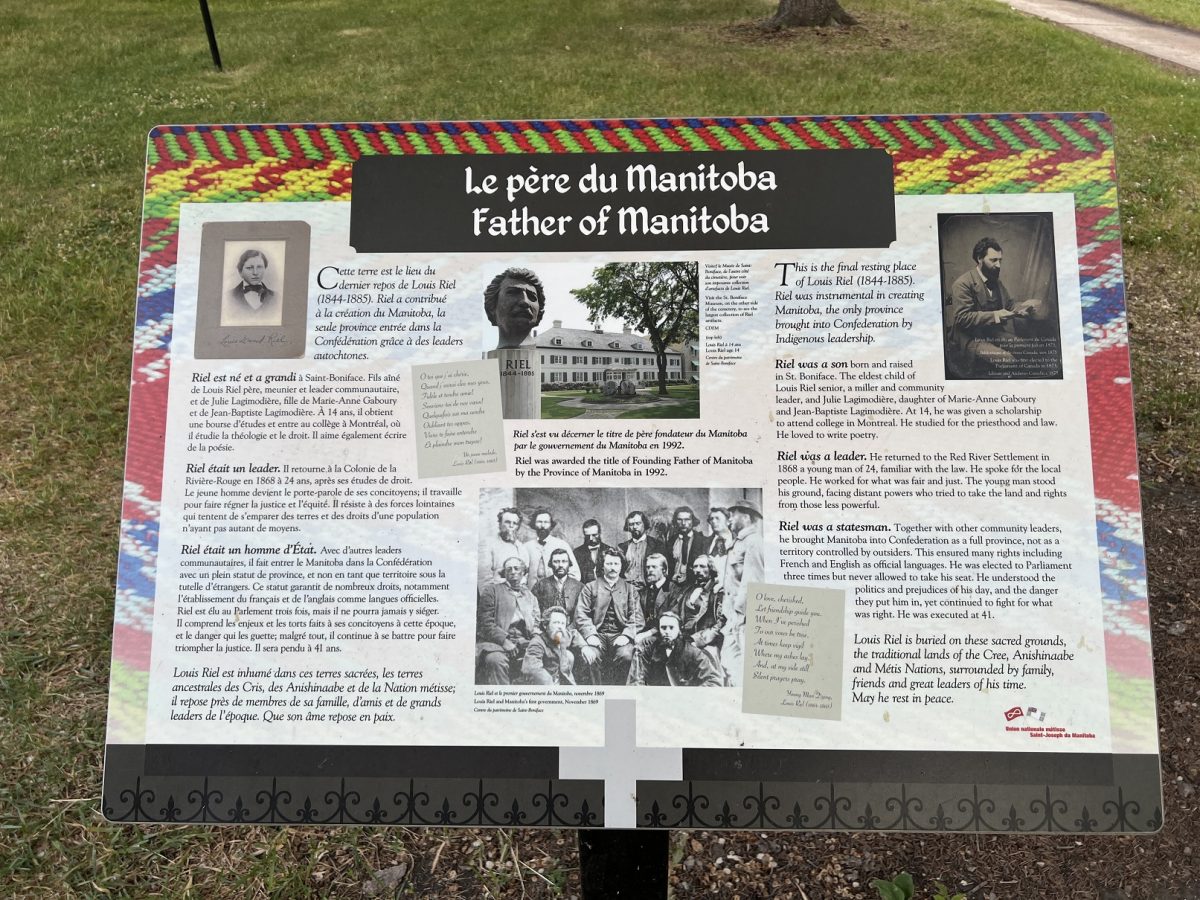
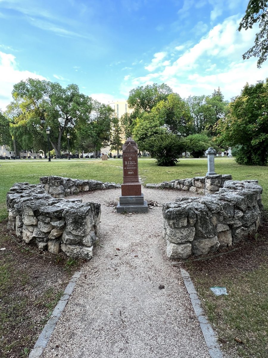
Louis Riel’s Tombstone. “Buried at St Boniface Cathedral Cemetery. Until the middle of the 20th century Riel’s reputation suffered under the scrutiny of many historians as just a treasonous troublemaker. But as attitudes towards Native nations began to change in the 1960s, his reputation changed along with them. He was finally recognized as an important figure in the founding of Canada’s central Province, and today he is a symbol to many as a defender of his Métis Nation and the rights of minority citizens. He has been honored in Winnipeg with an eponymous street (Riel Avenue), memorials, a pedestrian bridge, and Manitobans all celebrate Louis Riel Day every third Monday in February.”
Louis has been part of this trip. He has appeared in numerous places. It is only honourable that I visit his gravesite.
Universite de Saint-Boniface was established by Father Norbert Provencher (1787–1853) in 1818, making it western Canada’s oldest post-secondary educational institution. It began as a small school where Latin was taught to the boys of the French-speaking Red River Colony.
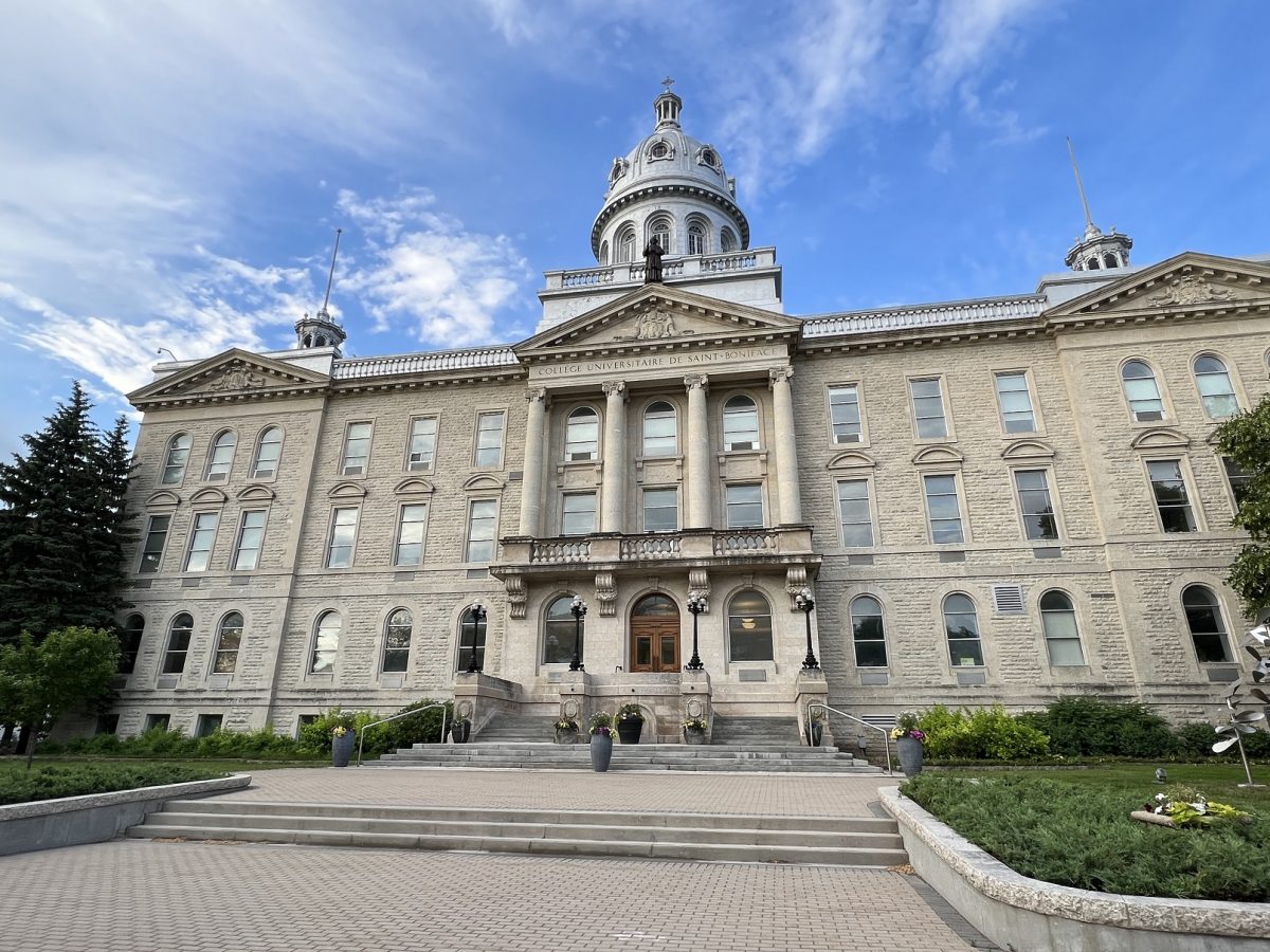
The original St. Boniface College building was built in stages between 1880 and 1902. It was destroyed by fire on 25 November 1922, along with all its records and library holdings. Operations were moved to the St. Boniface Seminary on Cathedral Avenue, which remains its location today.
Provencher School was located on three previous sites before moving to this building in 1908. The origins of the institution and the Collège de Saint-Boniface (St. Boniface College) date back to 1818 when Father Provencher arrived at the Red River Colony.
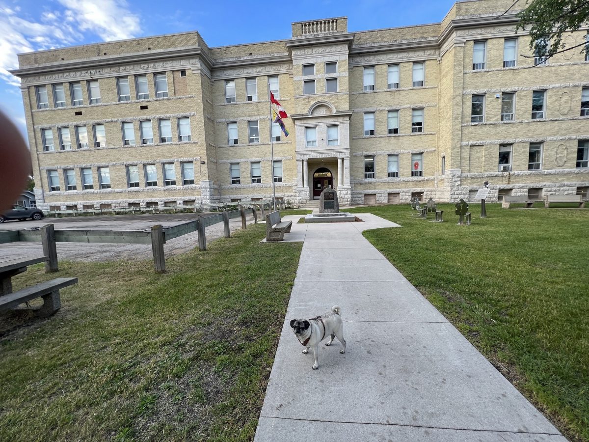
The school on de la Cathédrale Avenue was built in 1906 and was a boys’ school only. In 1912, the west wing was built to increase the number of classrooms, which totalled 36 in all. In 1968, girls were allowed to enrol at Provencher School.
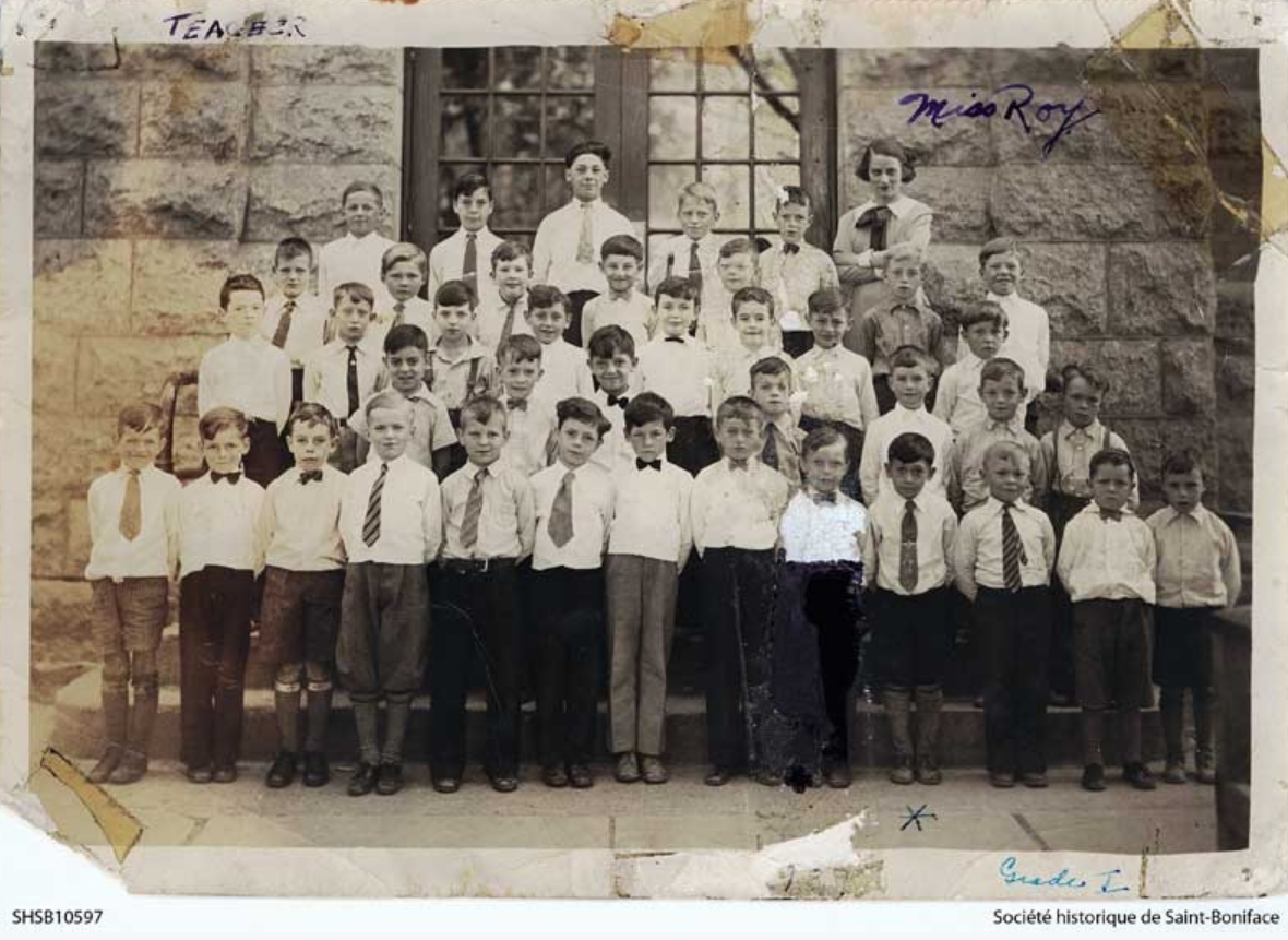
Canadian author Gabrielle Roy taught at Provencher school; seen in this photo standing in the back row.
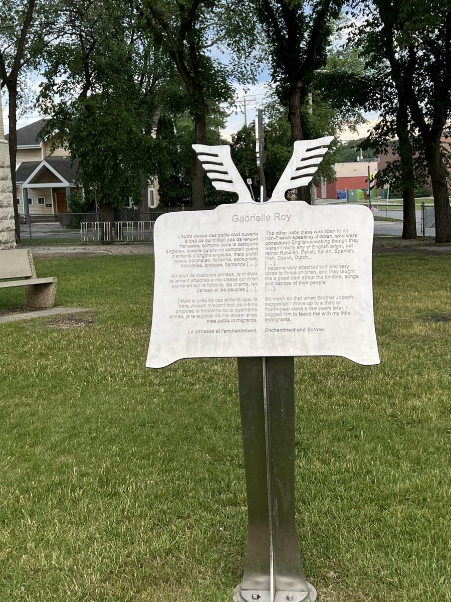
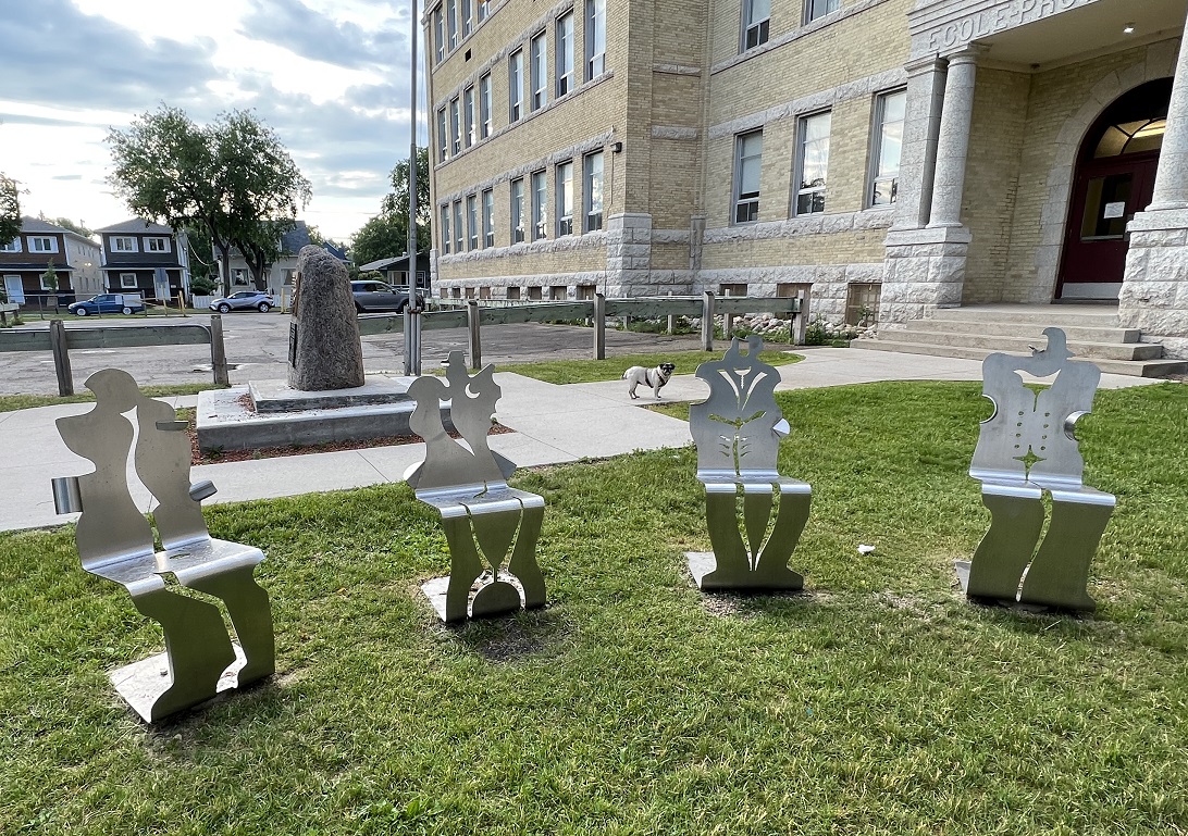
A quote from Roy on teaching immigrant children. The quote is on a lecturn facing the children’s chairs.
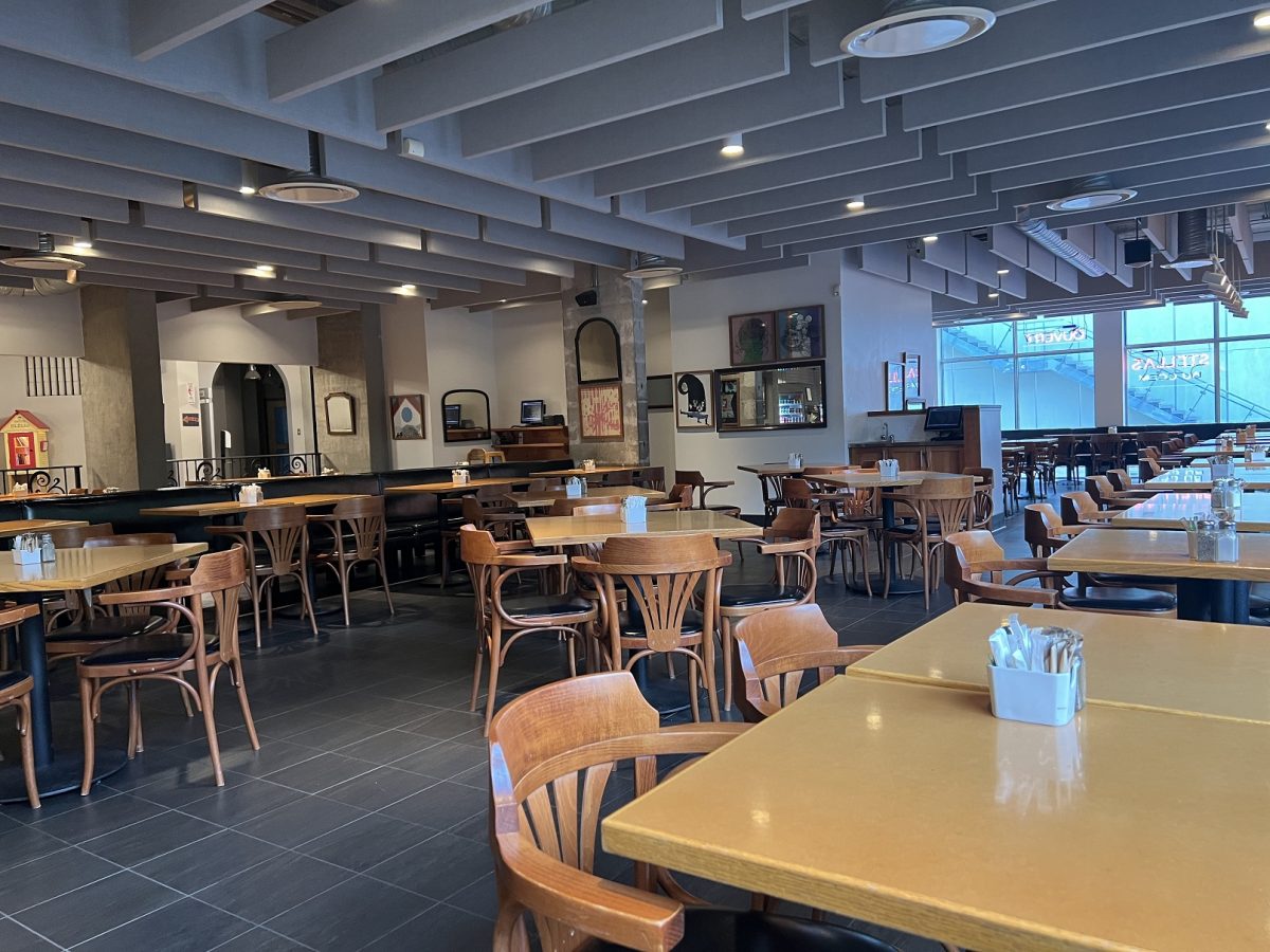
The CCFM – Centre Culturel Franco-Manitoban is in the French quarter. I was checking Google for breakfast places and Stella’s Cafe popped up. It’s located in the Centre. They were just opening when I arrived at 7 am.
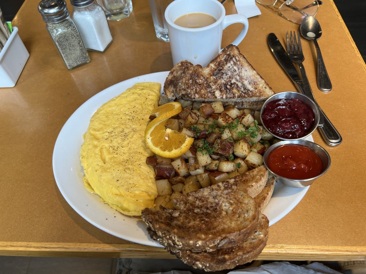
The orange was freshly squeezed and made my morning until the omelette came. With all of this on the plate the first thing my eyes saw was the strawberry compote. How often have you been served fresh strawberry compote with your toast?
When Stella came over to ask how everything was, I was slathering the compote onto a slice. I told her I was amazed that they served this. She said yes, people order it for their cereal, their ice cream and even by it to take home.
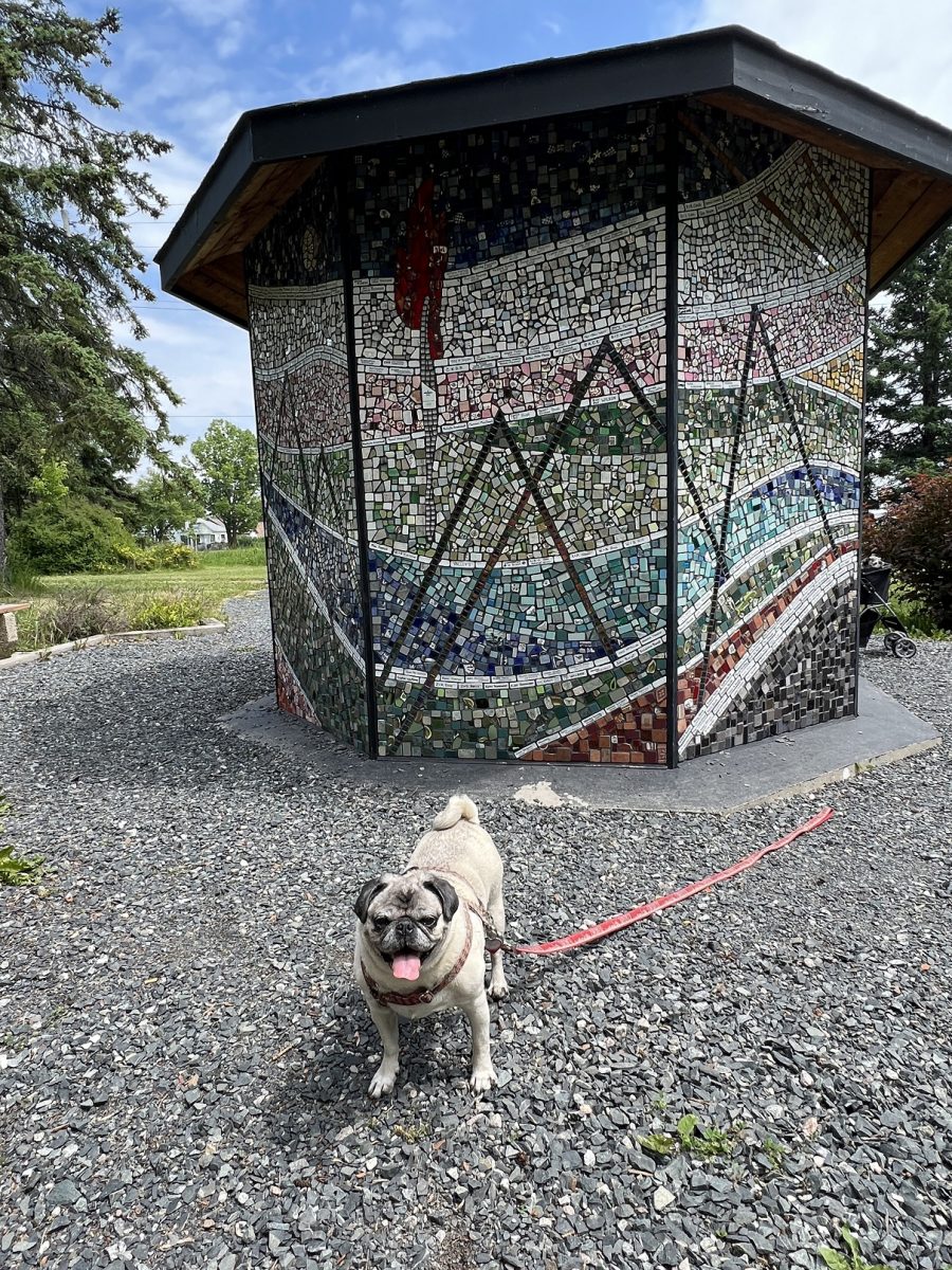
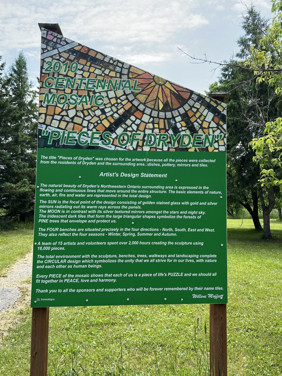
Johnston Park has a mosaic sculpture that citizens of Dryden contributed to. I took a picture of this side with Greta.
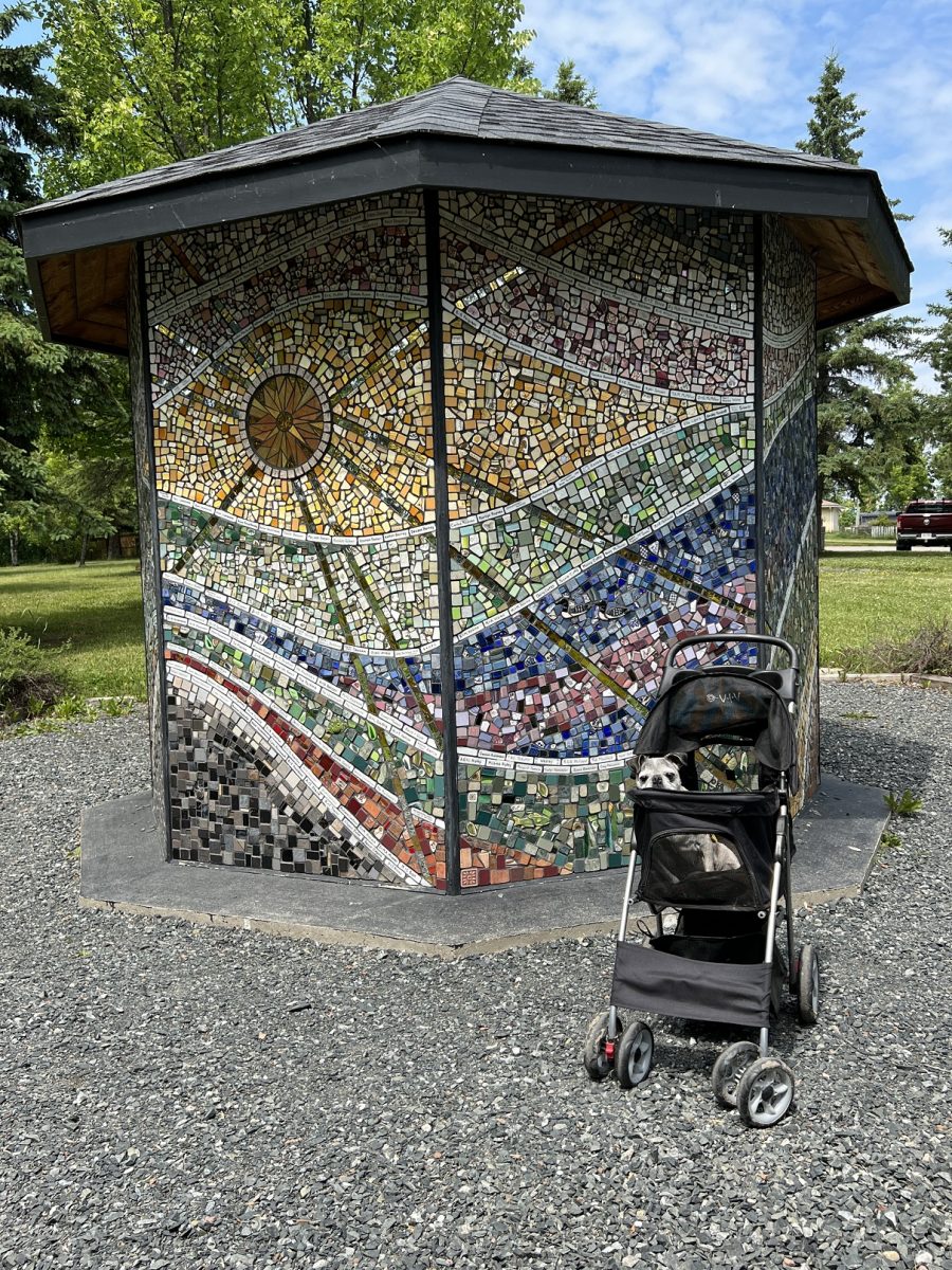
Then I shifted for this one. It is a Dryden Centennial masterpiece, featuring over 18,000 bits of broken pottery, each chosen for its particular color and shape to form a design that represents the elements of earth, water, air, and fire.”
The artist’s statement
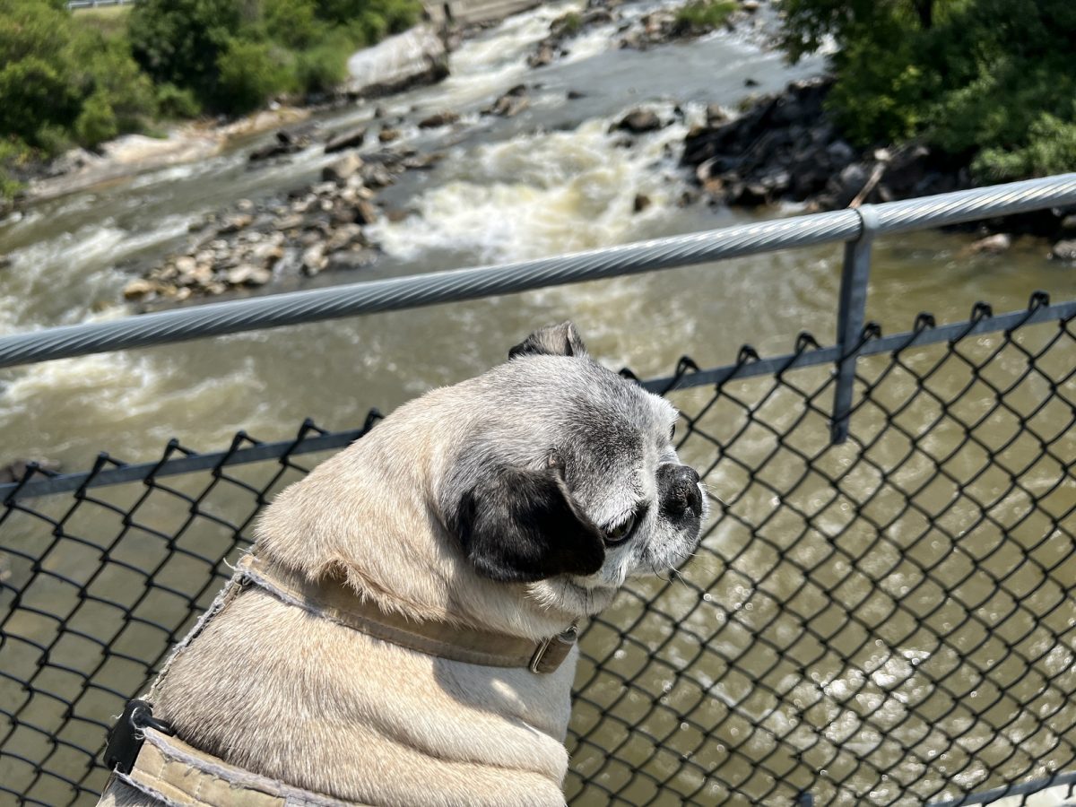
Roy Wilson Suspension Bridge is located down a path from the mosaic. “The Roy Wilson Suspension Bridge opened to the public in 2009. The Suspension Bridge is located behind the Chalet Inn on the City’s Trail Network. The bridge is 34 meter (111.5′), and spans the Wabigoon River just below the rapids. The suspension bridge is free to use and parking is available at Johnston Park on Highway 17.”
Obviously Eve remembered how suspension bridges work. Even though this wasn’t swaying as much, she still felt something was wrong with the boards beneath her feet. She did not care that it was free to use.
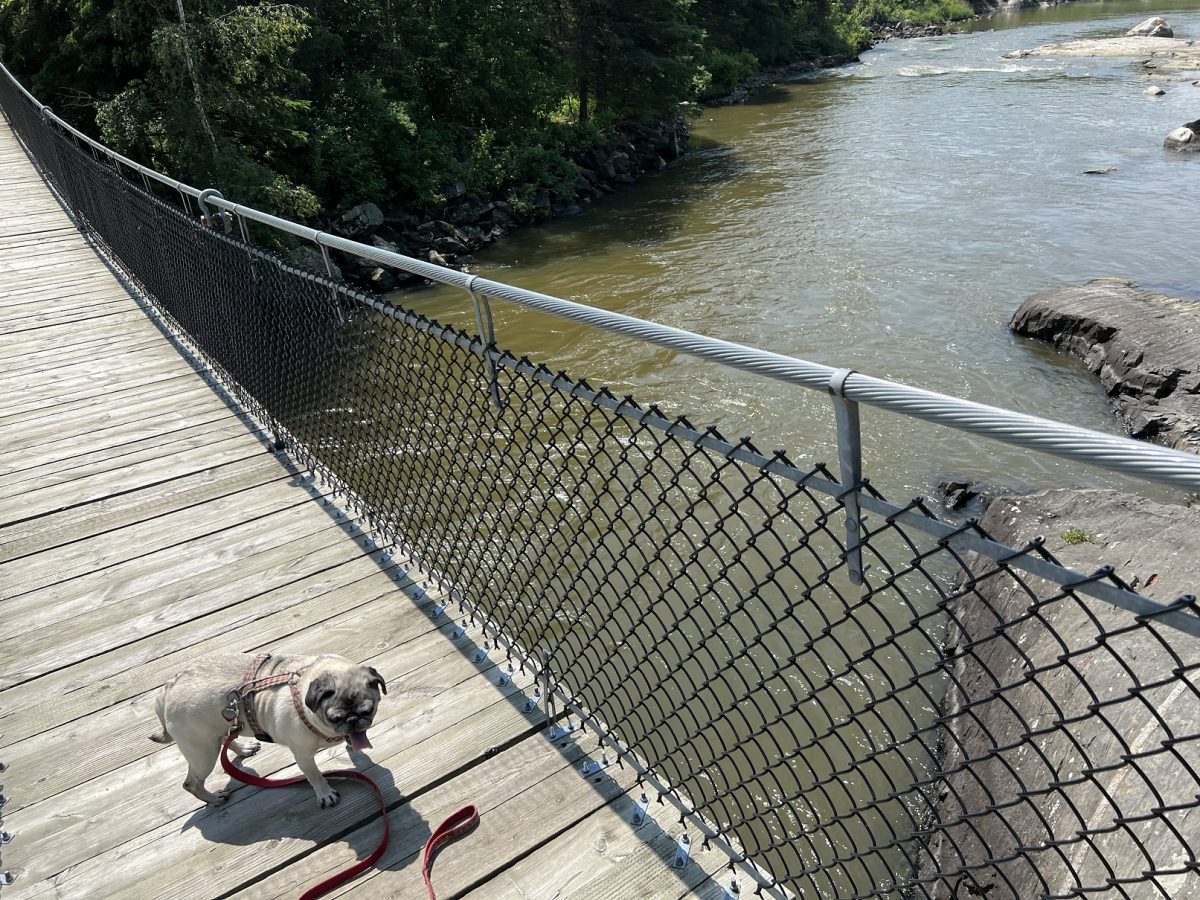
We had to climb some stairs to get to it so I left Greta’s stroller back and carried her. She was saying “What swaying?”
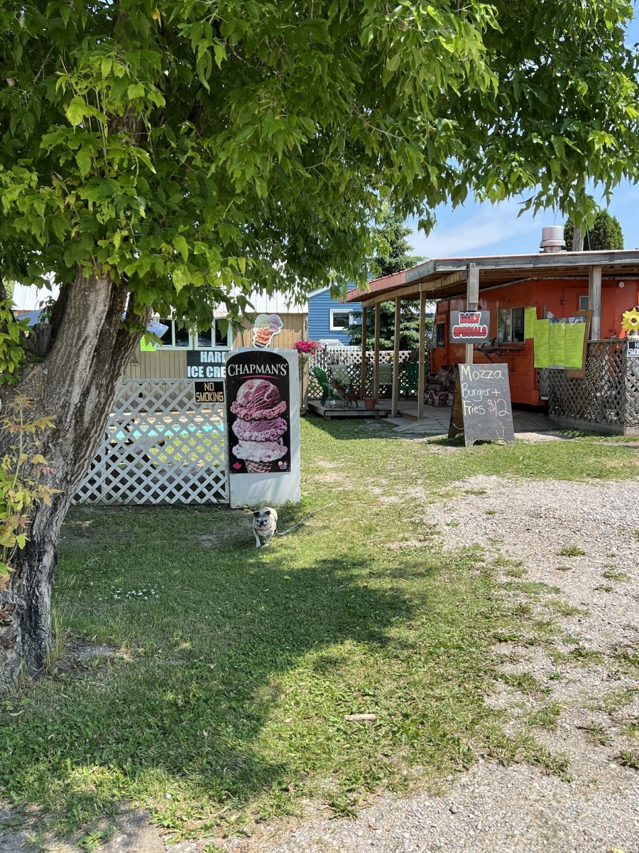
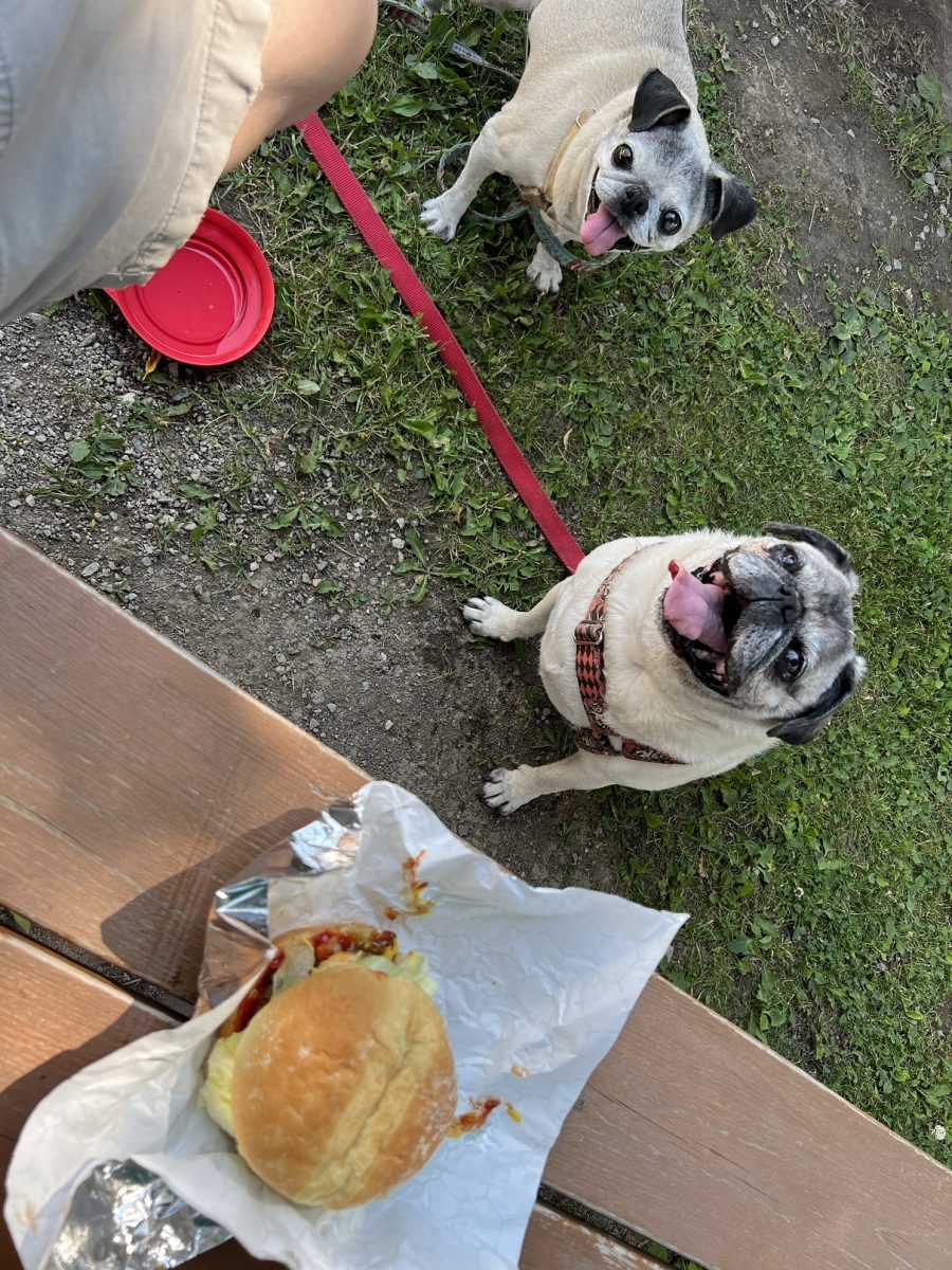
Just G’s Chip Stand was just down the road. They had shaded picnic tables. Greta was all excited for the Mozza Burger.
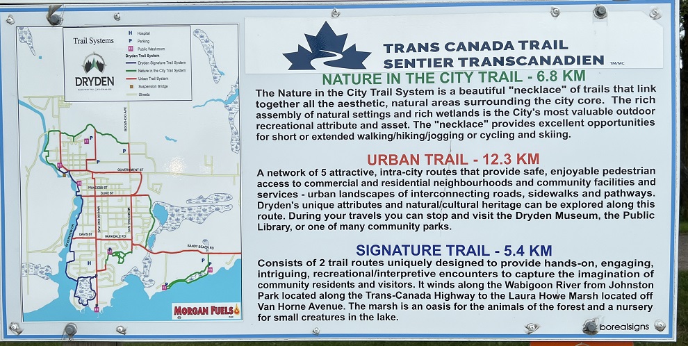
Dryden Signature Trail. “After taking a walk over the river, take your time and walk the Dryden City Trails. Take the Signature Trail (5.4 km) along the Wabigoon River to the Laura Howe Marsh, located off Van Horne Avenue. The marsh is an oasis for forest animals and a nursery for small creatures in the lake.”
The pugs were ready for dinner and a nap. Checked into the Best Western Plus out on the highway. It is a 2 storey building so more horizontal walking for Greta. It’s a nice room with the usual – 2 double beds. We will cozy up tonight.
I took the car back to town to explore one of the loops of the Signature Trails.
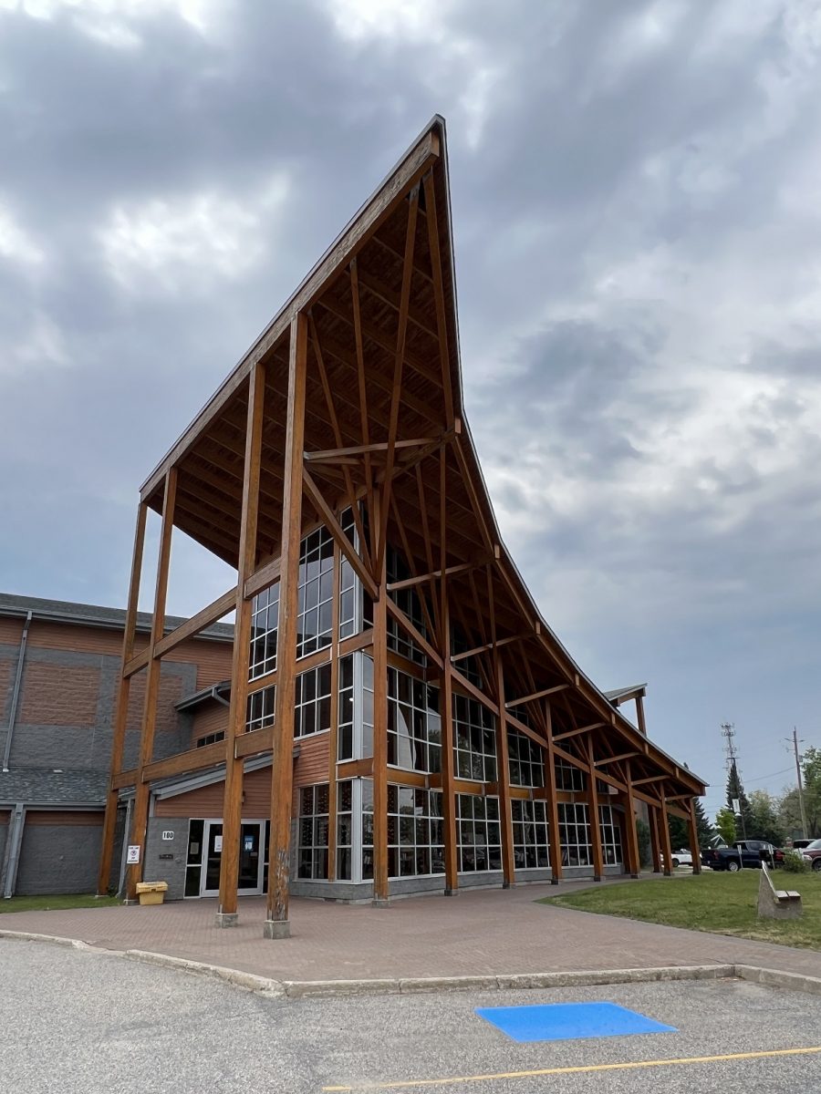
Dryden Regional Training and Cultural Centre. I went by a lot of houses. In fact, it kind of reminded me of the True Crime Trolley tour. I did go by an architecturally interesting building. It was the Cultural Centre that also acts as a training centre.
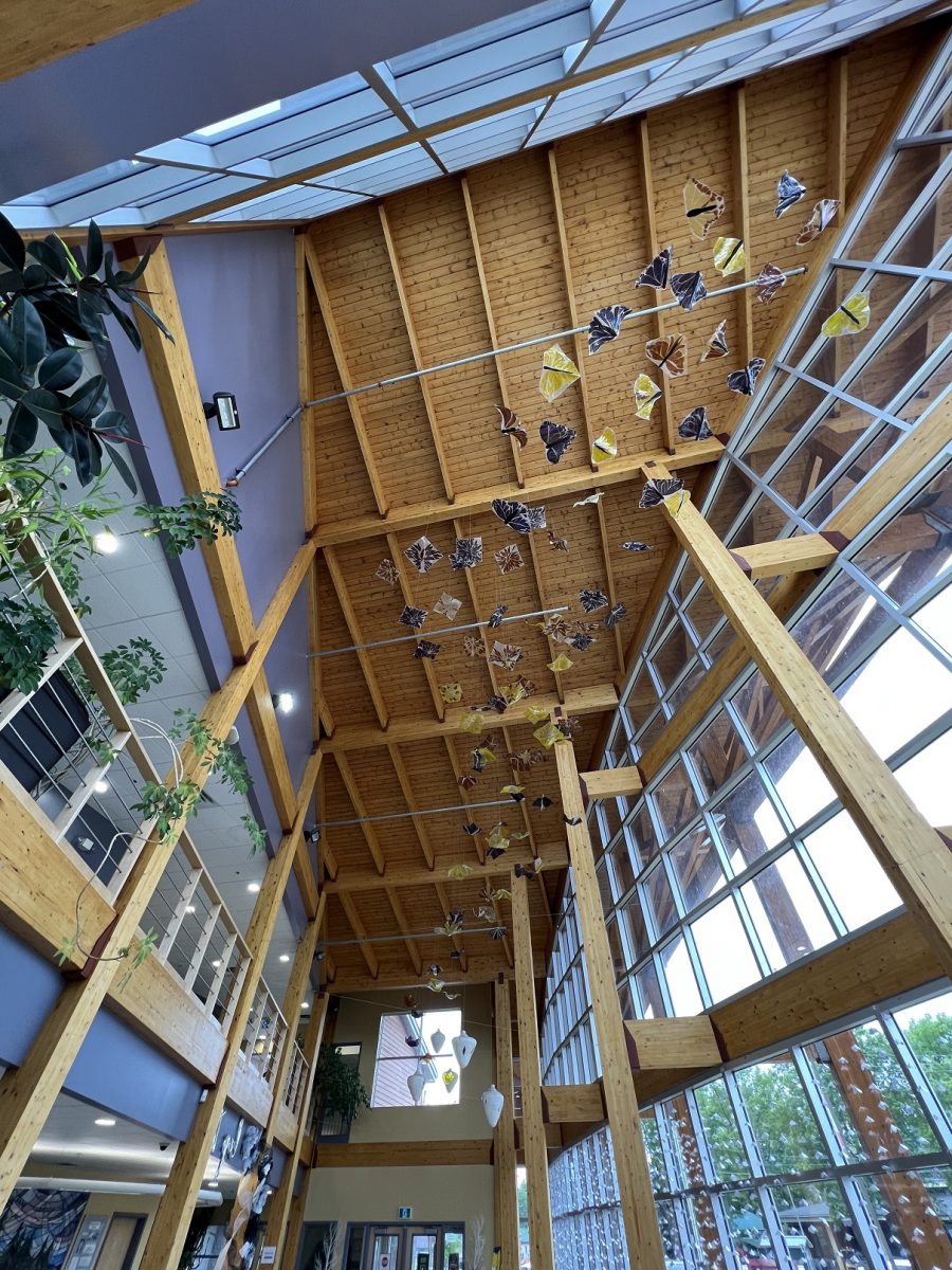
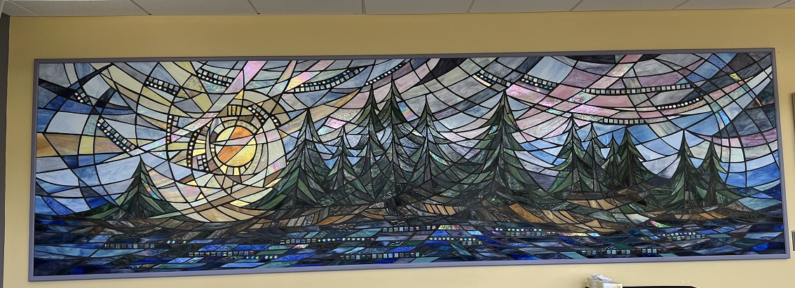
The door was open so went in. No one was around but took a couple of pics.
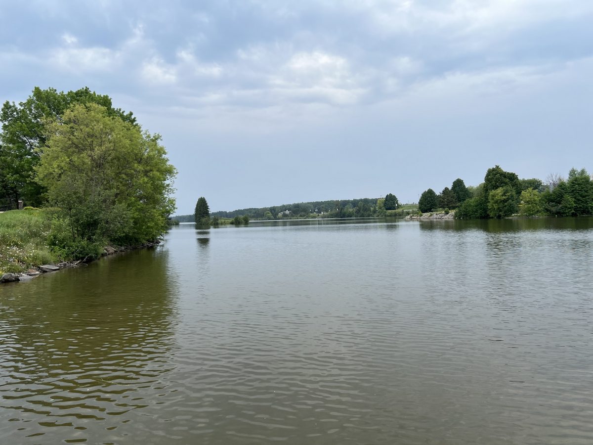
The loop tour then took me down to Cooper Park and the Wabigoon River. The city’s Pumping station was on this site – built in 1928 and ran for 48 years. There was a map of the different trails and distance.
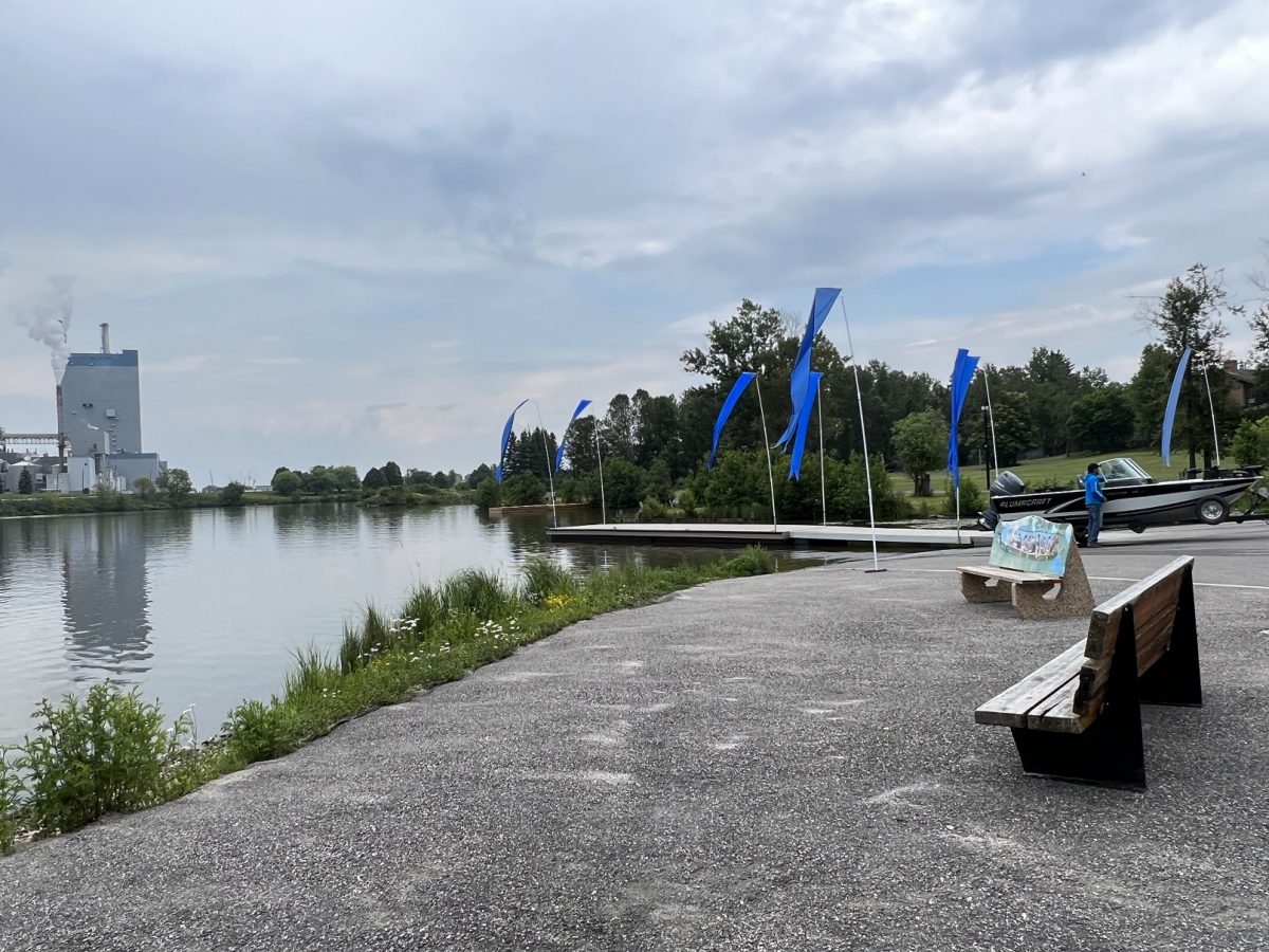
There was a floating deck going out into the water so I walked out to get a photo of the river.
A little farther down was Skene Landing was named after Alexander Skene. He owned the steam powered saw mill which was on this site (1896). He sold the mill, took up farming and represented Agricultural Minister John Dryden.
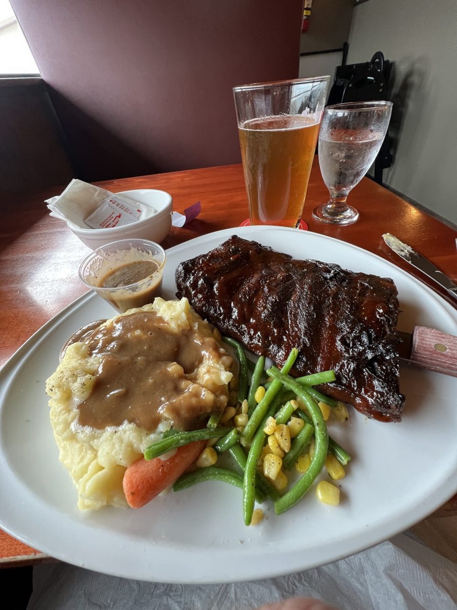
B&B Roadhouse Grill. It started to rain so headed back to the hotel. The B&B is located in the hotel. The special was BBQ ribs. The side was garlic mashed potatoes with gravy.
The rain was short lived. Took the girls out to a big grassy area in front of the hotel. It’s going to be an early night because it will be an early start. I’m driving from Dryden to Marathon, Ontario. And it will be a marathon. 4 hours to Thunder Bay then 4 hours to Marathon. Lake Superior is one big lake.
There wont’ be much happening – just driving and rest stops. If I see something interesting I’ll stop for a photo. It will be a balance of getting the miles completed but not exhausting myself.